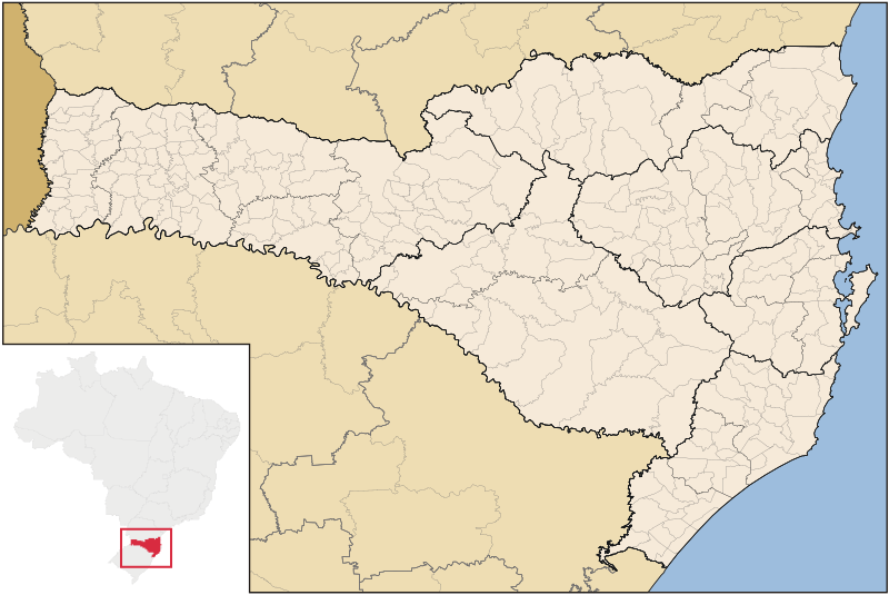
File:SantaCatarina MesoMicroMunicip.svg
外觀

此 SVG 檔案的 PNG 預覽的大小:800 × 535 像素。 其他解析度:320 × 214 像素 | 640 × 428 像素 | 1,024 × 685 像素 | 1,280 × 856 像素 | 2,560 × 1,711 像素 | 1,481 × 990 像素。
原始檔案 (SVG 檔案,表面大小:1,481 × 990 像素,檔案大小:662 KB)
檔案歷史
點選日期/時間以檢視該時間的檔案版本。
| 日期/時間 | 縮圖 | 尺寸 | 使用者 | 備註 | |
|---|---|---|---|---|---|
| 目前 | 2006年9月8日 (五) 04:52 |  | 1,481 × 990(662 KB) | Raphael.lorenzeto | |
| 2006年6月2日 (五) 10:47 |  | 943 × 691(613 KB) | Raphael.lorenzeto | {{User:Raphael.lorenzeto/DerivativeMaps}} {{Information| |Description=Map of Santa Catarina state |Source=own work |Date=June, 2 2006 |Author=Raphael Lorenzeto de Abreu |Permission={{self2|GFDL|cc-by-2.5}} |other_versions= }} [[Category:Maps of Santa Cata |
檔案用途
下列7個頁面有用到此檔案:
全域檔案使用狀況
以下其他 wiki 使用了這個檔案:
- br.wikipedia.org 的使用狀況
- eo.wikipedia.org 的使用狀況
- es.wikipedia.org 的使用狀況
- et.wikipedia.org 的使用狀況
- fi.wikipedia.org 的使用狀況
- fr.wikipedia.org 的使用狀況
- oc.wikipedia.org 的使用狀況
- Florianópolis
- Joinville (Santa Catarina)
- Balneário Camboriú
- Blumenau
- Itajaí
- Araranguá
- Biguaçu
- Chapecó
- Criciúma
- Abdon Batista (Santa Catarina)
- Abelardo Luz
- Agrolândia
- Agronômica
- Alfredo Wagner
- Alto Bela Vista
- Anchieta (Santa Catarina)
- Angelina (Santa Catarina)
- Anita Garibaldi (Santa Catarina)
- Anitápolis
- Antônio Carlos (Santa Catarina)
- Apiúna
- Arabutã
- Araquari
- Armazém (Santa Catarina)
- Arroio Trinta
- Arvoredo
- Ascurra
- Aurora (Santa Catarina)
- Balneário Arroio do Silva
- Balneário Barra do Sul
- Balneário Gaivota
- Balneário Piçarras
- Bandeirante (Santa Catarina)
- Barra Bonita (Santa Catarina)
- Barra Velha
- Bela Vista do Toldo
檢視此檔案的更多全域使用狀況。


